
Mapping and Imaging the Seafloor: Subsea Tow Camera System Improves Resolution of Seafloor Data
The most effective way to map the seafloor in detail is through the use of subsea cameras. Active sonar is used to map the seafloor. These maps and images are essential for ocean exploration, however, they are unable to provide details of what the seafloor actually looks like. Through the implementation of subsea imaging and camera systems, researchers and industry experts can now view and capture high-definition video and images of the seafloor in real-time. This development has changed the way we map the ocean floor, helping us better understand, and harness the potential of our oceans.
Since the early days of ocean exploration, ocean technology has had an extraordinary evolution, peeling back the curtain and revealing many of the mysteries held by the deep. Advancements in subsea equipment have allowed researchers to study even the deepest parts of our oceans, discover new species, and better understand ocean ecosystems. While ocean exploration has been made much easier by technological advancements, one area that long remained a mystery was the seafloor itself.
Modern technologies such as sonar, can provide depth readings and identify important features such as canyons or mountains underwater. By using transducers to produce acoustic pulses, sonar technologies can produce accurate images and maps that, while accurate, are not a true representation of what the seafloor looks like. To augment sonar data, it is becoming increasingly more common to employ subsea imaging and camera systems to increase the resolution of seafloor maps and fill in blind spots in sonar data.
Why Map the Seafloor?
Ocean exploration has existed for centuries, and seafloor mapping has existed just as long. In its early days, seafloor mapping was largely used to identify hazards on the seafloor that could impact vessels. These crude but effective maps allowed ships to avoid breaching on rocks, avoid shallow areas near ports, and prevent damage to vessels. While damage prevention and breach avoidance are still important, modern demands on our oceans have created the need for increased and more advanced mapping.
Seafloor mapping helps us better understand our oceans. It is a key practice in determining the best possible routes for shipping and transport, as well as ocean exploration and research. Mapping provides ‘eyes’ on the seafloor, in areas that are not easily accessed by humans. Subsea mapping has solved many mysteries of the past, allowing researchers and ocean archeologists to uncover shipwrecks and vessels, thought to be lost forever. Seafloor mapping is also helping to solve modern mysteries, by assisting in the search for lost aircraft, and uncovering vehicles and tools lost at sea.

Image credit: NIWA
Ocean imaging and seafloor mapping are essential for deep-sea mining and mineral extraction, as well as oil and gas exploration. Mapping must be carried out before any installation of infrastructure, including for offshore wind, ocean research and observation, and fiber optic communication cables. Seafloor mapping ensures that not only will infrastructure be placed in the correct areas, but that these installations will have the least impact possible on the surrounding environment.
As we demand more and more from our oceans, it is imperative that ocean infrastructure is effective and sustainable, while also making little to no impact on the environment. This means that the tools and technology used to map and explore the seafloor must evolve along with this demand.
Mapping Methods: Soundings to Sonar to Subsea Cameras
From soundings to sonar, seafloor mapping has seen tremendous advancements.
Soundings
Weighted lines, called soundings, were used to map the seafloor. Early maps were created by measuring the tension in the line and identifying when it became slack. This was repeated several times until a pattern was formed. This practice could only identify large features and could only be carried out close to shore, severely limiting the scope of what could be mapped.
Sonar
In the early 20th-century sonar systems began mapping the seafloor. By creating an acoustic pulse and measuring the strength of the return signal, sonar systems can create accurate images and maps of the sea floor. Over the last century, sonar systems have advanced to become reliable and effective mapping and imaging tools. However, sonar systems are expensive and require extensive training and expertise, as well as a large amount of space for deployment and use. Active sonar systems are also known to be disruptive to aquatic life, and they cannot produce detailed images that are true to the seafloor. These are some of the reasons why researchers and industry leaders are turning to subsea camera systems for marine observation and mapping needs.
Subsea Cameras
Static and mobile camera deployments offer a unique alternative to mapping through sonar. Where sonar provides information for users to interpret, subsea cameras are a real-time window into what’s happening below the surface. There is no need to interpret or guess at camera data, as it is like seeing with your own eyes. Subsea camera and imaging systems have advanced to where images and videos taken underwater have the same detail, clarity, and quality of images taken on land. These systems tend to be more compact than other mapping systems and they can be deployed to great depths and provide intricately detailed images and video. While previously depth and lack of light were limiting factors, modern camera systems are equipped with LED lights and lasers, and can withstand the enormous pressure at even the deepest points of the ocean. These all-in-one systems are becoming the gold-standard in detailed seafloor mapping, as they provide high-definition images and video, true to seafloor.
Benefits of Subsea Imaging and Camera Systems for Seafloor Mapping
SubC’s Tow Camera System
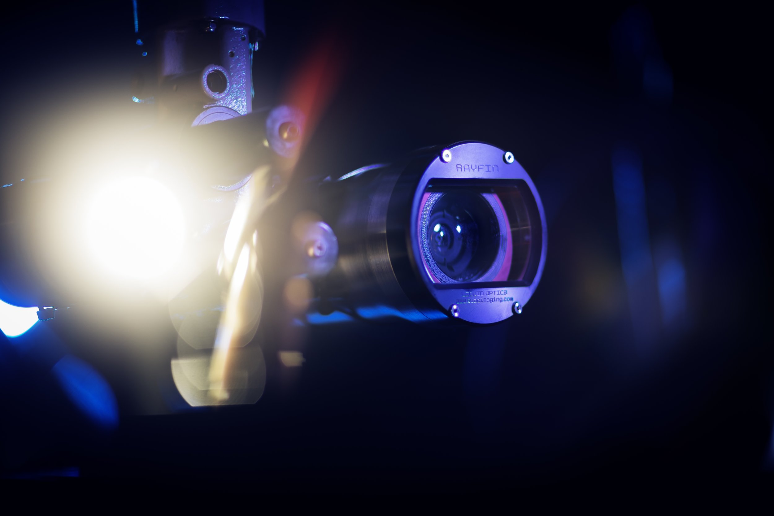
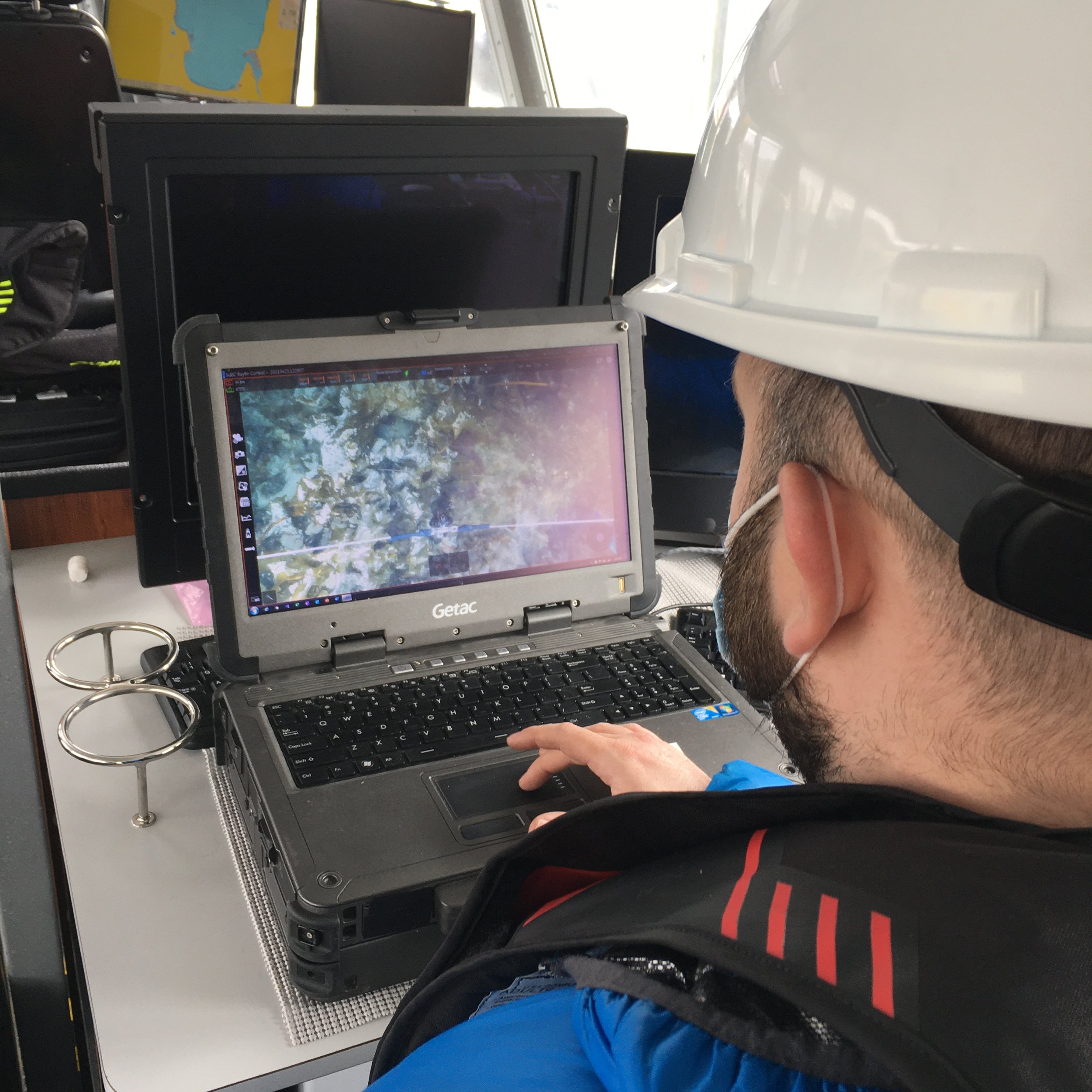
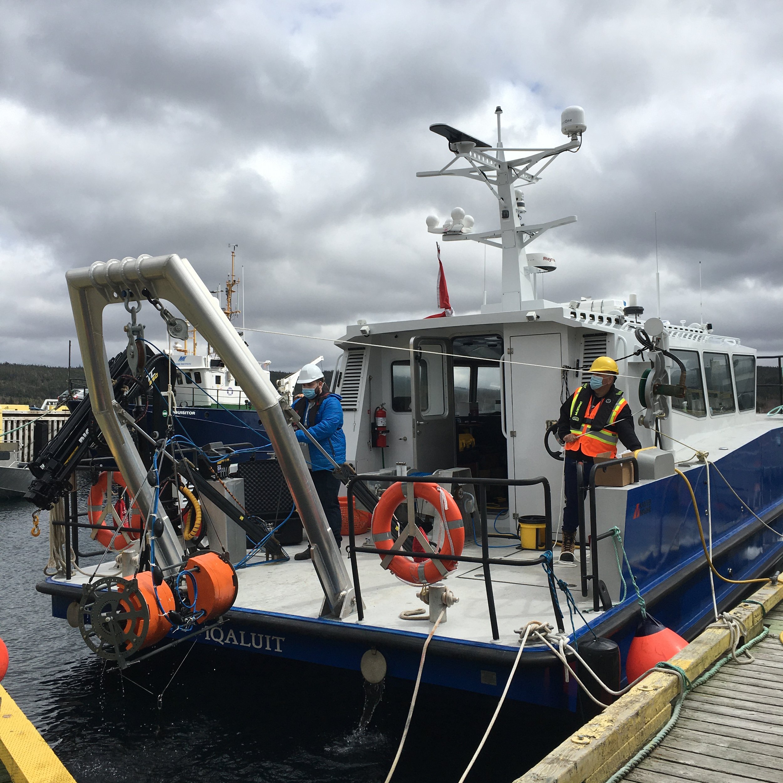
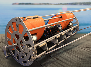
Subsea imaging and camera systems, such as those designed and built by SubC Imaging, can deliver video and images in real time, and they can be adjusted and adapted during active deployment. While static deployments can provide excellent data, the most effective use of underwater camera and imaging systems for mapping is through a Tow Camera System. This camera system combines a Rayfin Coastal camera with LED lights and lasers, all inside a sturdy frame. Once connected via a kevlar tow cable, this durable plug-and-play mapping system is ready to deploy. The Tow Camera System requires far less space and is easier to use than traditional sonar systems, resulting in significant cost reductions as there is no longer a need to hire a large vessel or a team of sonar experts.
SubC Imaging’s Tow Camera System has been tested in some of the harshest aquatic environments, including the North Atlantic. This system is non-invasive, user-friendly, and cost-effective, while also providing high-quality data that can be viewed in real-time. The Tow Camera system is ideal for marine observation, seafloor mapping, fisheries research, conservation, and search and rescue missions, as these systems can cover large areas in short periods without sacrificing data quality. Other applications include marine litter identification such as ghost fishing gear, biodiversity monitoring, seabed characterization, and detection of hydrothermal and other geological features.
Tow Camera System: How It Works
Traditional video mapping techniques use sleds that are towed along the seafloor. The Tow Camera System designed by SubC Imaging effectively performs ocean mapping and imaging activities without making contact with the seafloor. This is made possible through the mechanical design of the system. Using the principles of hydrodynamics and buoyancy, the Tow Camera System uses a small drag chain and a clump weight with an embedded altimeter to passively control the distance to the seafloor from the camera system. This ensures that photos and videos have a consistent subject distance. The intelligent design of the Tow Camera System minimizes contact made with the seafloor, resulting in little to no interference or destruction of the natural environment.

Each component of the Tow Camera System has been designed and built to be exceptional on its own, however, once combined, they create a complete system capable of mapping and imaging even the most difficult areas under harsh conditions. The integrated sensors provide real-time data on the altitude and depth of the system, as well as roll and tilt. The Tow Camera system is capable of NMEA data logging, compatible with all modern GPS systems. This system can therefore be used for any kind of ocean survey that requires consistent transect imaging of the seafloor.

Seafloor Mapping and the Ocean Decade
The United Nations Ocean Decade has listed ten challenges, one of which is “the development of a comprehensive digital representation of the ocean.” In response to this challenge, the Seabed 2030 project was launched. Seabed 2030 aims to map the entirety of the seafloor by 2030 and, to date, approximately 25% of the seafloor has been mapped. The majority of this mapping has been done through modern multibeam sonar systems. Subsea camera systems can make significant contributions to the mapping efforts of Seabed 2030 while removing some of the barriers that traditional sonar systems present. As the Ocean Decade progresses, employing the use of new technologies such as subsea camera systems for marine observation and tow camera systems for seafloor mapping and ocean imaging can help the world achieve ocean sustainability goals.


Conclusion
The importance of seafloor mapping has been known for centuries. From the earliest maps created using soundings to prevent breaching and shipwrecks to the sophisticated sonar images produced today, seafloor mapping and subsea equipment have undergone a significant transformation. As our demands and needs from our oceans continue to grow, so must our understanding of the aquatic environment. By employing the use of new technology, such as subsea cameras and imaging systems, huge tasks, such as mapping the entirety of the seafloor by 2030, become less of a pipedream and more of a feasible goal.
As we progress through the Ocean Decade, the need for seafloor mapping will only increase. Camera systems are a viable way to map the seafloor, acquiring essential and high-quality data, in a way that is both environmentally and cost-conscious, as well as accessible and convenient.